Friday, June 21, 2013

June 21, 2013

Hello Summer


Started todays travels with two scenic byways.

First it was back up the Salmon River Scenic Byway. 


Same road we came down yesterday but this time we continued up river another 35 miles to Stanley, ID.  Small town with expensive mountain "cabins" in a mountain valley.  From Stanley the road turns south on the Sawtooth Scenic Highway and continues up the flat but gently climbing valley.


 At the head of the 20 mile long valley the road crosses a small stream.  So small it fits in a small culvert.  One could step across it without reaching.  The Salmon River.  Remember the pictures from previous posts.
 After crossing the head of the valley the road starts to climb more seriously.  5% grade - not too bad for carbus.  It also twists and turns but also not bad.  Had worse two days ago over pass north of Salmon.  Carbus handled it well.  Near the summit there is an overlook.  Looks down on the headwaters of the Salmon River and down the valley.
Headwaters of the Salmon River


Culvert holding Salmon River is just to left of 'Y' in road lower left
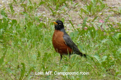
 
 
 Over Galena Summit (8990') and down to the south.  A few more twists and turns and 5% grade.  Easy driving.  Thirtyseven miles from the summit we entered Ketchum, ID.  Neighbor to Sun Valley and home of famous ski resorts.  At the north end of town we stopped to visit the cemetary.  We are really into cemetarys but could not pass this one up.
 

.
Ernest Hemmingway on right.  Wife, Mary, on left


South from Ketchum on the road most use to enter Ketchum we met US 20 and turned east on a road we have traveled before.
 Fifty miles later we passed Craters of the Moon National Monument.  We have been there before so moved on up the road to Arco, ID.  Pulled in to the same RV park we stayed in earlier (looking forward to tomorrows free breakfast) and set up.

Since it was still early afternoon we decided to take the car and drive 20 mile down the road tour EBR-1 National Historic Landmark.
 EBR stands for Experimental Breeder Reactor.  This is/was the worlds first nuclear reactor and it was also the first to generate electrical power.  The reactor was long ago decommissioned and is radiation free.  Visitors are free to wander pretty much any where inside the building.  There is a self guiding pamphlet and docents also give a thorough tour if available.  We lucked out and got a personal guided tour (just the two of us).  The young woman who guided us was very knowledgeable about the reactor, The Idaho National Laboratory, and nuclear power in general.  She presented information in a manner that was easy to grasp.  We got a large education in an hours time.
First use of nuclear generated electricity.  Lit four lights similar to these.  Next day lit whole plant.


Somebodys really great idea.  This contraption was designed to provide power to fly an airplane for up to 30 days non-stop.  Several problems.  The plant itself weighs more than a 747.  Plane to hold it would be HUGE.  Nucular shielding was minimal to none.  Crew flying plane would receive more than lifetime radiation dose during their 30 day flight.  Would be training new crew every month to fly plane.  Idea never got off the ground so to speak.
 
Description of EBR-1 tour  http://www.inl.gov/ebr/
 
Back to the carbus to write these blogs.

June 20, 2013

Goodby Spring

Layover day. 
We read in the AAA tour book about a back country road scenic drive.  Since we were there to see things we decided this would be fun and something the average tourist doesnt do.  The Custer Moterway starts about five miles west of Challis.  It follows the route of a former wagon tollroad that serviced the mining areas of Custer and Bonanza located deep in the backcountry.  The road is one lane with wide spots.  Nicely groomed gravel and dirt mix to roadbed.  Smooth and level.  Easy driving.  Used 4WD mostly to exercise 4WD and for a bit more control but 2WD cars could do road easily.
 Shortly after starting the motorway we headed up something called Corkscrew Grade. 

Twists and climbs up and around the side of a mountain then follows a river and climbs following the river up and then after about 8 miles, over the summit or the road.  8794 feet elevation.  Had a few light snow fluries over the summit.  Neat.
White on trees is very light dusting of snow
 
 From the summit the road follows the route of another creek/river for eight or ten miles to Custer City.  Many back country camp spots along the way.  Very pretty spots to spend some time. 
Pretty country

.
These guys were setting up a fish counting fence

One of two we saw all day
Custer City Cemetary.  Used when weather and other conditions prevented getting to Bonanza cemetary.  Seven graves.
 
Custer City is/was where the people who worked in the Custer Mine lived.  It is now a museum.  Many open buildings and many trails with interpretive signs.
Ore collection bin @ Custer Mine
 
  Another three miles and the road passes the Yankee Fork Gold Dredge.
  A little smaller than the one we toured in Dawson City but the same idea.  It was built 5 1/2 miles downstream and worked its way up the canyon filling the canyon floor with tailings. 
Over the years the dredge produced $1.1 million at a cost of production of $1.4 million.  :(    The dredge has docents who give tours. 

Several miles further the road passes the site of the former mining town of Bonanza.  Just a few buildings remain. 

Bonanza Cemetary
Bonanza
 
Another ten miles to Sunbeam Hot Springs and the Salmon River Scenic Byway (ID 75).
Portion of dam placed across Salmon River to provide hydroelectric power for mines.  Half of it was removed to restore natural flow to river.
 
 We headed downstream back to Challis and the carbus.
 
Salmon River


Rafting the Salmon.  Wish we had the time to do it.

 Great tour.

View from the carbus this evening.  Hard to make out but it is a full rainbow.


Wednesday, June 19, 2013

June 19, 2013

Back in Idaho on the Salmon River


Two more days with Mike and Gladys and then east toward our adventure.  Stopped in Coeur d'Alene for gas.  Combination of Costco pricing and lower tax in Idaho made it pretty good deal.  Then accross the Idaho panhandle to Montana.  Not a fan of interstates but the scenery is great and the road is easy driving.


 We have driven I90 from Spokane to Missoula several times so we recognized the sights and turnoffs we had previously taken.  Did not stay in Missoula this time but headed south a few miles to Lolo, Mt.  In Lolo there is a state park/national historic site called Travelers Rest.  It is a spot where Lewis and Clark camped on their journey.  Very pretty area.  Flat valleys filled with trees and rivers running through them.  We stayed in a RV park/Square dance club (go figure) several miles from the main highway.  Large sites scattered amongst the trees.  Full hook ups, very good wifi, and a whiffle ball golf course (a first for us).  Could see spending several days there.

This was our odometer reading when we parked in our campsite. Cool huh?

Today we continued south to Salmon, ID.  The is flat for 40 or 50 miles up the Bitterroot Valley.  It is so flat that there is a bike trail the whole way. 
First half of day's drive was in rain

Eventually the road starts to climb into the Bitterroot Mountains.  Good road that twists up to Chief Joseph Pass at 7280'.

 A few miles down the south side of the pass the geology starts to change.  Bitterroot Valley and Mountains are green with lots of trees typical as seen in the Sierra.  South of Bitterroots things change to high plains/dessert.  Mountains give way to bare buttes and hills.  Evergreens give way to deciduous and sage brush. 

We stopped in Salmon, ID to have lunch. 
Salmon River - "The River of No Return"
 
We decided to go an hour further south for the day and stopped in Challis, ID.  Small town with a rather depressed economy.  Local mine is major employer and it is cutting back.  The area is also not the most hospitable climatewise.  Challis gets less precipitation per year than Phoenix. We may stay here an extra day to take a scenic drive and also check out a road we would like to drive in the carbus on our way south.
I know this picture is contrary to what I wrote above but other direction IS baron.  Snow on mountains is what fell from storm we drove through.  Yesterday the mountains were bare.


Monday, June 17, 2013

June 15, 2013

Spokane

The bed is great!  Slept very well.

From Bend we went north to Moro.  Small farm town that has a fairgrounds and associated RV park.  Not fancy but it is quiet, clean, well maintained, nice view, and very reasonable.  $16 for full hookup, WiFi, and cable.  Showers also.
View from RV park - Mt Hood (20x)


The 14th we headed east up the Columbia River.  When the river turned north we continued east to Pendleton.  Have wanted to visit the woolen mill for years and we were again in the area so why not?  Nice tour shows you the entire process from wool to woven blanket.  Lots of amazing machines.  The weaving machine can weave a twin bed sized blanket with an intricate design/pattern in it in 15 minutes. 
Original building - well over 100 years old

Sample of intricacy possible on looms at this plant

Demo of various stages of wool processing


North from Pendleton through Walla Walla to a quiet little RV park four miles from the main road and near a river.  Passport America saved us 50% so only cost $12.50.


Today we went north through eastern Washington farm land. Miles and miles and miles and .... of wheat.  The topography here is not like Kansas.  The land is hilly.  Rounded top hills but rather deep and narrow gullies between.  Every bit of the hills is planted with wheat in patches that circle the hills.  Farm/ranch buildings are nestled in the gullies.  Lots of up and downs to the roads.  

We arrived at the home of our good friends, Mike and Gladys, about noon.  After settleing in the carbus and a nice lunch they took us on a drive south to Pullman, home of Washington State University. 
 
Goal was to visit a creamery that is part of the universitys Ag program.  "Best ice cream in state."  Unfortunately the creamery was only open on week days and we were there on Saturday.  Still we got a tour of the campus.  Big school built on a number of hills.  Walking to class would keep you in shape there.  On our return toward Spokane we stopped at Steptoe Butte.  This is a peak of hard volcanic bassalt in the middle of softer land of the general area.  Over eons the softer land has eroded away leaving the harder peak sticking up in the middle.  Sort of like the Sutter Buttes but condensed to one peak.  The peak must be 1000 feet above the surrounding land.  From the summit you can see over 50 miles  in all directions.   Watched a crop duster from above.  Pretty neat.


Town of several hundred people that we drove through on our tour
 
Brings to mind a golf course designed by the Devil

Before our trip to Pullman we visited a state/city park in Spokane.  Lots of walking/hiking/biking trails.  Camping sites AND the Spokane River flows through it.  The city Parks and Rec Dept does a rafting concession on the river.